![]()
![]()


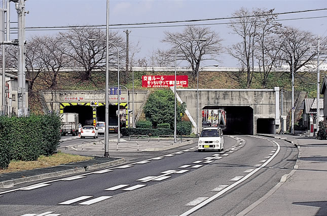
Kusatsu River flowing above Japan National Route 1
Driving on Japan National Route 1 along the shore of Lake Biwa, you will come across a small tunnel near Kusatsu City. As a matter of fact, running overhead is not a road but the Kusatsu River. Even JR line also runs under Kusatsu River.
The mountains of Kotou contain large amounts of granite which resulted in heavy excavation, and thus great amount of sedimentations were washed away. Subsequently, the sediment made
the riverbeds shallower, and easily caused floods. As a result, the locals were forced to keep dikes higher and higher on both sides. In this way, Kusatsu River eventually ran several meters above level ground. Accordingly, rivers with high inner beds are not unusual in Kotou.
In the downstream of these rivers, water is easily absorbed into the ground and using surface water is extremely difficult.
Since ancient times, residents of the lower areas in this region have devised unique irrigation methods for collecting submerged water. And in marshlands near the lake, people drew water from satellite lakes via creeks and pumped it up to their paddies by treadmills called tousha (literally “stepping wheel” in Japanese).
In any case, it is ironic that this area facing the largest reservoir of Japan, Lake Biwa, suffered from water shortage, which made a clear contrast with the plains in the downstream of Yodo River.
It was in 1905 that people started using steam engines to pump up water from Lake Biwa so that a large area of 150 hectares could be irrigated. By curious coincidence, this was also the year when Nango-araizeki (Nango Regulating Weir) was completed.
Perhaps, it was not curious coincidence but people concerned just set the date intentionally. It was obvious that the water level in Lake Biwa would go down when the weir started operation. Indeed, from this day, irrigation with surface and ground water pumped up by electricity spreaded rapidly across the region (naturally, costs for buying and maintaining motors, fuel, etc. were additionally needed).
Even the slightest fluctuations in water level of Lake Biwa had always been a matter of life or death for nearby inhabitants. The focused issues which were left to the final stage concerning the coordination of The Lake Biwa Integrated Development Plan were how the water level of this lake should be decided.
The term gyakusui-kangai (pump irrigation), which is unique to this region, must have become well known since yr1929, when the Prefecture-Operated Douji River Irrigation Project was launched. This involved an unconventional system in which water of Lake Biwa was pumped up near the mouth of Douji River and conveyed to far upstream in order to irrigate 536 hectares of paddy field in the upper reaches.
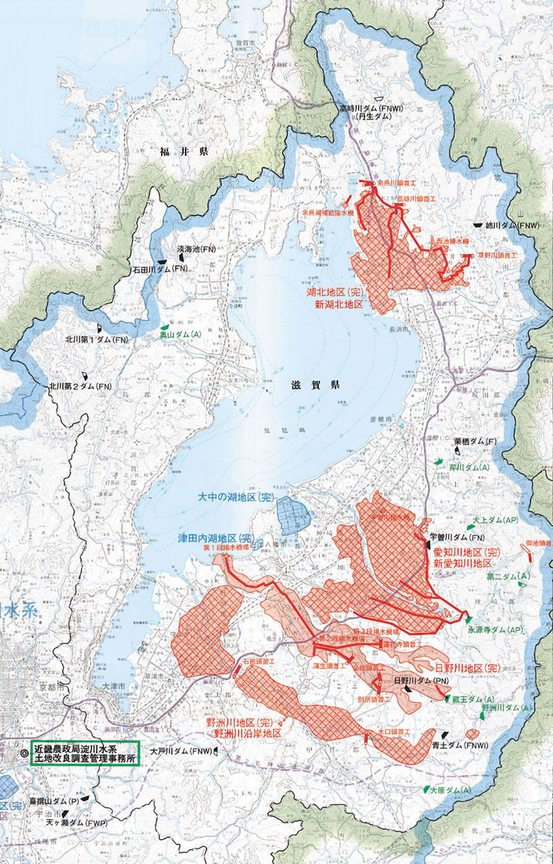
Further, a large-scale dam was constructed upstream by a national project. The region came up with a complex and elaborate water-use system in which various water intake methods including pumping, groundwater, reservoirs, and river water were established (see map below).
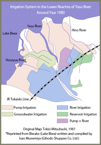
Irrigation System in the Lower Reaches of Yasu River
Around Year 1980
Pump irrigation circulates water within a region which is independent of the external water sources despite being located within the large water systems of Lake Biwa or Yodo River Basin. This is, so to speak, the idea of using water by recycling.
The most ambitious and extensive realization of this concept is the Kohoku Irrigation Project.
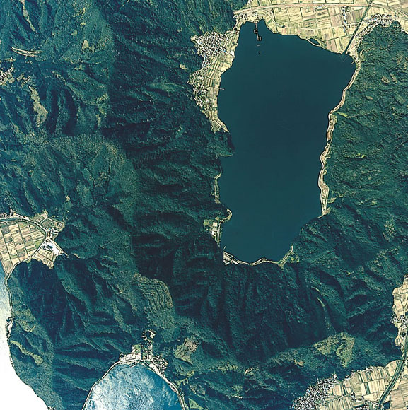
At the northern spot of Lake Biwa, there is a small natural lake called Lake Yogo.
The 5,000 hectares of paddy field located to the south of this small lake originally depended on several rivers for irrigation including the Takatoki River, but the catchment area was so small that farmers should suffer from scarce water resources.