![]()
![]()

Naniwa (now Osaka) was known to have happyakuyabashi (literally “808 bridges” in Japanese), while Edo (now Tokyo) was happyakuyacho (literally “808 towns” in Japanese). At the end of the Taisho era (year 1926), there were actually more than 1,600 bridges in Naniwa.
Today, about half of these rivers were buried as sewage facilities were developed. Even so, the total length of all of Osaka’s bridges is more than 40 km.
Osaka is a city of water. This is due to the fact that almost all of today’s Osaka City, excluding the Uemachi plateau, was either sea or marsh in the third to sixth centuries. The Osaka Plain of that time is shown in the map below. The marsh was called Lake Kawachi and this area occupies the greater part of Kawachi Plain today.
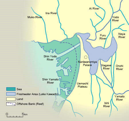
Map of Osaka, 1600-1800 years ago
Reprinted from Yodogawa Nogyo Suiri Shi (History of Agricultural Water-Use Along Yodo River) by the Kinki Regional Agricultural Administration Office
In the Yamazaki area, Seta River (Uji River) merges with Katsura River from the Kyoto Basin and Kizu River from the Iga Basin,to form Yodo River. The name “Yodo” must have come from the Japanese word yodomu meaning “stagnant,” as the river’s gradient gets even smaller at this point.
In addition, in Kawachi, several rivers including Yamato River running from Nara Basin, were converged.
Rainfall in this enormous catchment area encompassing 8,240 km2 (the seventh largest in Japan) came together to Yodo River. Naturally, this was a regularly flooded area. However, at least until year 1890 or so, farm produce in this region was transported by boat. There were almost no roads, and then boats loaded with harvest went back and forth along canals extending like networks. In year 1670, in response to a petition by farmers along Lake Biwa, Seta River was dredged for the first time with 140,000 laborers deployed
in total for this work. Unfortunately, just four years later, the lower areas of Yodo River were hit by unprecedented flood. Naturally, downstream inhabitants must have
gotten mad.
Since around this time, concerning flood control, serious conflicts between farmers along Seta River (Lake Biwa farmers) and those along Yodo River (Kawachi farmers) had begun.
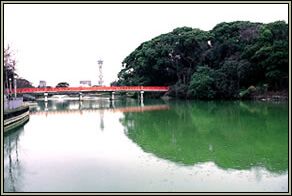
Riverbed Lake in Tennouji Park
Floods repeatedly struck the area before, as a matter of fact. Records indicate that Yodo River was flooded at least 239 times, or approximately once every five years from years 623 to 1868.
The fervent desire of the people in this region from ancient to modern times has always been flood control.
However, if dikes were constructed to protect against flood,farmers would lose the waterways for draining their rice paddies. Drained water from rice paddies, called akusui (literally “bad water” in Japanese), was a problematic water which made their fields muddy. Effective water intake and drainage are both essential for rice farming.
The long-cherished wish of the Kawachi farmers was to have Yamato River rerouted.
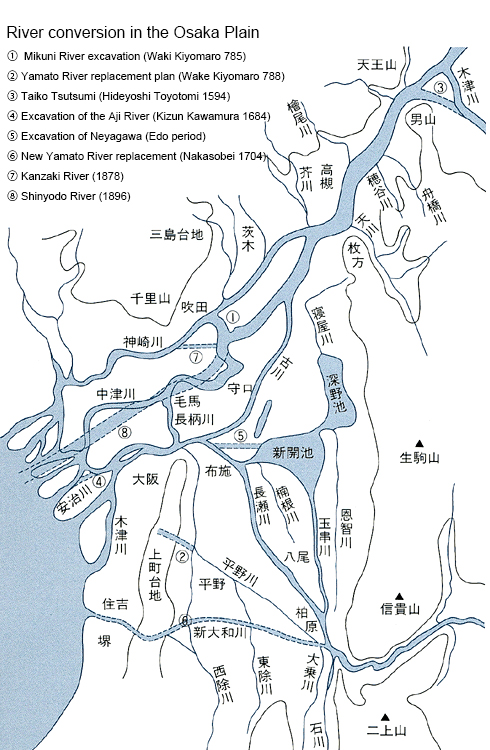
Changes in Rivers in the Osaka Plain
【 Reprinted from Daichi-E-No Kokuin (Carving into the Earth) 】
The shogunate including Kawamura Zuiken who devoted most his lifetime to flood control, attached great importance to water transport through Yodo River. Boat passage along this route was often obstructed by great amounts of debris carried in from Kizu River, which made the riverbed shallower. Rerouting Yamato River would make Yodo River even shallower.
Unlike the flourishing area along Uji River, Seta River and Yodo River were caught in a win-or-lose relationship, in spite of the fact that these were only different in name but actually the same river. A drastic solution was indeed postponed to the Meiji era when the Yodo River Improvement Project started, and the Showa era when the Lake Biwa Integrated Development Plan started.
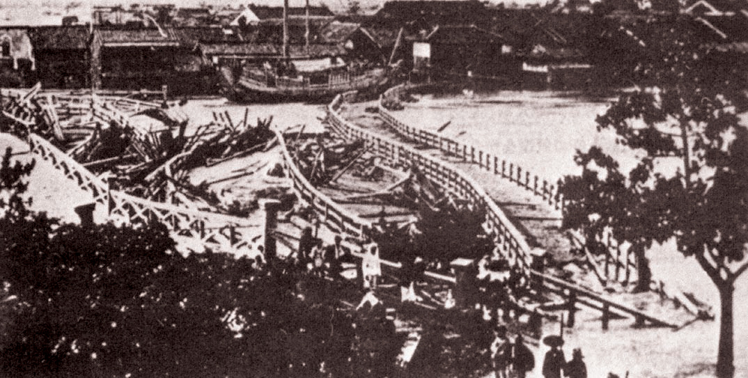
Aji River Bridge Flooded in 1885
【 Reprinted from Yodogawa Hyakunenshi (100 Years’ History of Yodo River) by the Kinki Regional Construction Bureau 】