![]()
![]()
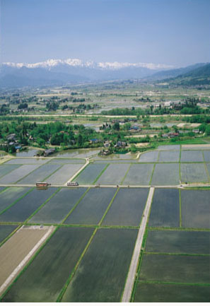
Depending on the geographical features, paddy fields spread out either straight along from top to bottom of the alluvial fan or in a spoke-like fashion.
Naturally, river waters diminish as they flow downstream, and villages and fields ended where rivers dry up: in other words, the rivers taper off.
Azumino villages were developed in the fish-scale patterns from the upstream areas of the alluvial fan. Around the lowest marshy area, where rivers converged and spring-water was available, villages began to form at a relatively early stage. As is mentioned above, the expanse of flat land in mid-stream comprising the greater part of the alluvial fan,remained dry until the middle of the Edo era.
The question was how water could be brought to these dry areas. Because upstream water had mostly already been taken, taking water in from downstream was also impossible, It was a hard problem to solve.
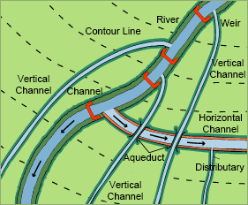
Please take a look at Illustration 3, once more (on the previous page).
Halfway up the alluvial fan, the number of irrigation canals have markedly increased. In this zone, we can see several canals that cut across the slope.
Usually, irrigation canals are built straight along a slope like a skier making a straight downhill descent (see illustration on left). In this way, flow velocity can be kept high and water can travel long distances.
However, there are some other canals flowing crosswise, almost parallel to the contour lines, like a skier traversing a slope. In other words, they are drawing water neither from upstream nor downstream, but laterally. Naturally, these canals intersected with existing channels at right angles.
Rural Landscape of Azumino and the Northern Alps