![]()
![]()
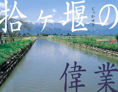
Despite a number of development projects, a huge expanse of uncultivated wilderness was still left in around present Hotakamachi. It was in 1816 that Jikkasegi (Weirs of Ten) was constructed, which
might be praised as the highlight of all horizontal channels in this region.
It is Azumino’s largest irrigation canal, cutting across the center of the large composite alluvial fan along the roughly 570-meter contour line. It takes water from Narai River like others and irrigates approximately 1,000 hectares of paddy fields.
It is approximately 15 kilometers long with a gradient of approximately 1/3000.
This gradient of water, 1 meter/3 km, is almost within the margin of error: that is, equivalent, for example, to moving the summit of Mount Yarigatake (3,180 meters high) just one meter sideways. Needless to say, it was constructed not by using modern leveling instruments or telescopes, but rather by manual digging alone, using only hoes and rope baskets.
Moreover, it was constructed in an astonishingly short time, only three months from start to completion. Azumino is harsh in winter. It was absolutely necessary to begin as soon as spring arrived and to finish before the rainy season. The total number of paid laborers was 67,000.
Jikkasegi (literally “Weirs of Ten” in Japanese) is said to be named after the ten villages where water is brought to.
Many people deserve praise for this astounding achievement, however Todoroki Magoichiro, headman of Kashiwara village, is especially noteworthy. He spent 26 years scrutinizing the terrain and negotiating successfully with the Matsumoto feudal clan, even as he endured assaults by thugs of the project’s opponents.
26 years: the land surveys in Todoroki necessitated the time close to half of a human life: On the contrary, the construction itself took just three months.
Thanks to Jikkasegi, Azumino was transformed into one of the finest rice-producing regions in Nagano prefecture. Needless to say, this channel is still actively working now, bringing water to the paddies of Azumino.
The photograph below is an aerial shot of the area around Hongo in Hotakamachi, taken in 1948. The channel running through the center is Jikkasegi. The beneficiary regions below the channel are the neatly rearranged paddy fields. What a difference between irrigated land and the non-irrigated! This photo shows vividly just how important Jikkasegi is to the region.
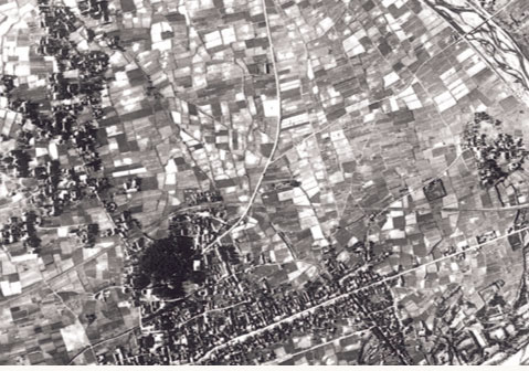
Aerial Photograph of Jikkasegi