![]()
![]()
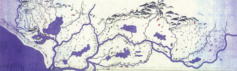


Map from Year 1648
This map was made in year 1648, during the reign of Iemitsu, third shogun of the Tokugawa dynasty. It is especially surprising that the Shinano, Agano, and Kaji rivers, which have some of Japan’s largest catchment areas, are all directed toward a point of the Niigata estuary. This means that all the rain and snow falling onto the vast mountain ranges in the background eventually gathered into the Niigata Plain, and that there was only an outlet for all these rivers. Accordingly, it is not too much to say that there were no years without any floods.
Yet, even in such tumultuous conditions, numerous villages formed along the rivers, as if to cling to their banks. Perhaps it was since this period that “enduring such hard work for the sole purpose of gaining food” became a daily scene, which the aforementioned novelist observed.
This coincides with the times when many daimyo (feudal lords) in Kanto, Noubi, and other large plains carried out historic river works and new paddy development projects. However, during the Edo era, this area in the Niigata region was scrambled by the Shibata, Nagaoka, or Murakami clans and by the Tokugawa shogunate. A different clan actually meant a different nation. The gruesome history of battles over water rights, thus, was not solely due to natural factors.
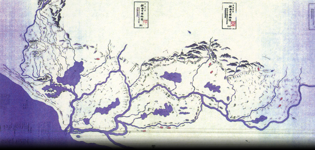
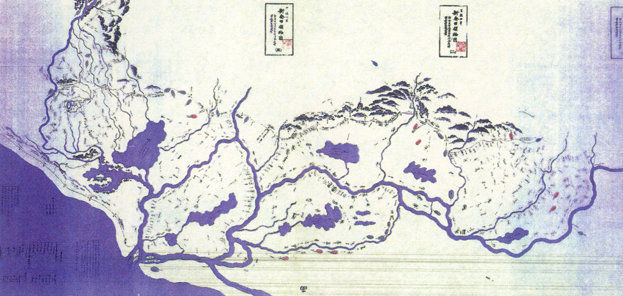
Let’s take a look once again at the current map of the Niigata Plain shown in Chapter 5.
We can see that the hillocks along the shoreline have been cut deeply so that each river flows independently into the sea today. For the most part, this was accomplished by projects implemented in the Edo and Meiji eras (from the 1600s to the 1800s). Village rivalries on the both sides of river were so intense that if a dike on an opposite bank broke, the people the original side that escaped flooding on the other side would make toasts and drink in celebration, so much so that jealousy and conflicts between clans were rife. Naturally we can imagine construction that changed river paths caused harsh dispute in these days when a drop of river water was synonymous with a drop of blood.
Even the construction of the Ookouzu diversion channel from the Shinano river in the Meiji era, known as a remarkable historic achievement, had its origins in a petition campaign promoted by a village headman, Honma Kazuemon. The campaign spanned generations through the struggles of numerous progressive farmers such as the Tazawa father and son and took nearly 200 years to the goal. During those 200 years, countless lives were sacrificed due to either construction labor or flood damage.
Map from Year 1648